


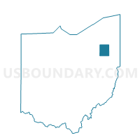
AURORA 1-A Voting District, Portage County, Ohio
About
Outline

Summary
| Unique Area Identifier | 651028 |
| Name | AURORA 1-A Voting District |
| County | Portage County |
| State | Ohio |
| Area (square miles) | 0.22 |
| Land Area (square miles) | 0.22 |
| Water Area (square miles) | 0.00 |
| % of Land Area | 100.00 |
| % of Water Area | 0.00 |
| Latitude of the Internal Point | 41.34595280 |
| Longtitude of the Internal Point | -81.38540060 |
Maps


Graphs
Select a template below for downloading or customizing gragh for AURORA 1-A Voting District, Portage County, Ohio


Neighbors
Neighoring Voting District (by Name) Neighboring Voting District on the Map
- AURORA 1-B Voting District, Portage County, OH
- Voting District Bainbridge Twp I, Geauga County, OH
- PRECINCT REMIND VILL A, Summit County, OH
- Voting District SOLON-03- A, Cuyahoga County, OH
Top 10 Neighboring County Subdivision (by Population) Neighboring County Subdivision on the Map
- Solon city, Cuyahoga County, OH (23,348)
- Aurora city, Portage County, OH (15,548)
- Bainbridge township, Geauga County, OH (11,395)
- Reminderville village, Summit County, OH (3,404)
Top 10 Neighboring Place (by Population) Neighboring Place on the Map
Top 10 Neighboring Unified School District (by Population) Neighboring Unified School District on the Map
- Solon City School District, OH (23,894)
- Kenston Local School District, OH (17,402)
- Aurora City School District, OH (15,873)
Top 10 Neighboring State Legislative District Lower Chamber (by Population) Neighboring State Legislative District Lower Chamber on the Map
- State House District 41, OH (126,531)
- State House District 17, OH (124,619)
- State House District 68, OH (124,596)
- State House District 98, OH (115,232)
Top 10 Neighboring State Legislative District Upper Chamber (by Population) Neighboring State Legislative District Upper Chamber on the Map
- State Senate District 24, OH (359,580)
- State Senate District 28, OH (354,926)
- State Senate District 27, OH (348,274)
- State Senate District 18, OH (345,273)
Top 10 Neighboring 111th Congressional District (by Population) Neighboring 111th Congressional District on the Map
Top 10 Neighboring Census Tract (by Population) Neighboring Census Tract on the Map
- Census Tract 6003.01, Portage County, OH (8,894)
- Census Tract 1841.08, Cuyahoga County, OH (7,433)
- Census Tract 3118, Geauga County, OH (7,306)
- Census Tract 5301.01, Summit County, OH (5,089)